


Hydrographic and Bathymetric Surveys | UK Services
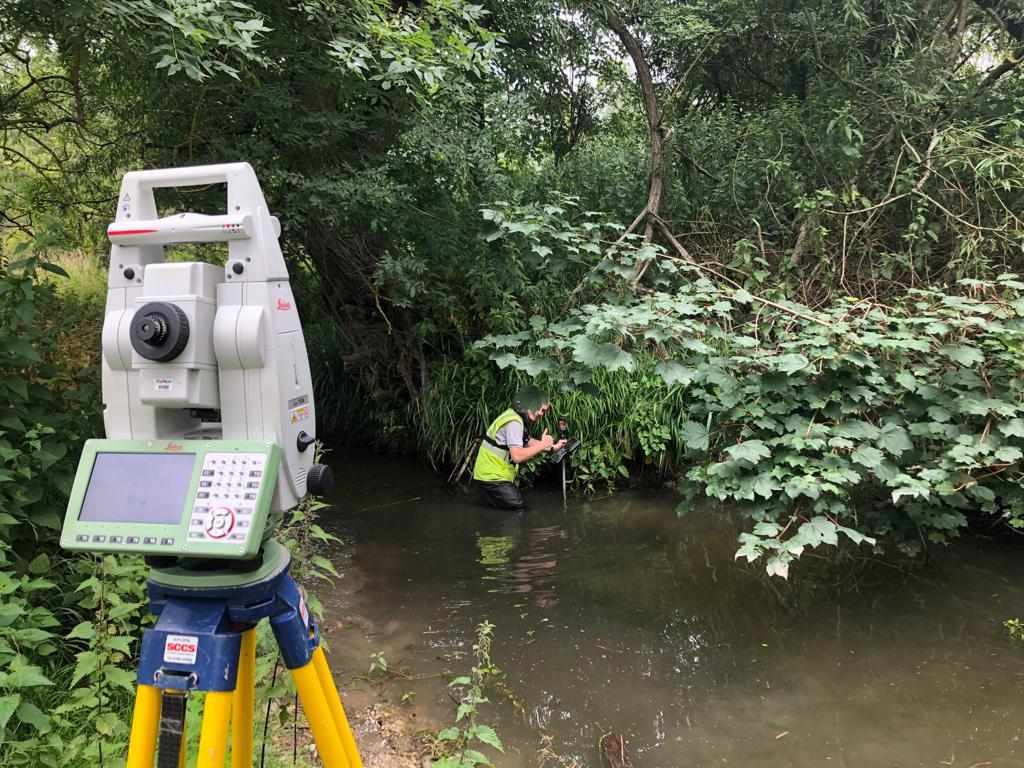
Hydrographic and Bathymetric Surveys for UK Projects
Accurate information about underwater environments is essential for planning, designing, and managing projects near rivers, ports, coastal areas, reservoirs, and other bodies of water. Hydrographic and Bathymetric Surveys help project teams understand water depths, underwater terrain, and relevant features that may affect construction, navigation, or maintenance.
For organisations planning marine, coastal, or inland water projects in the UK, reliable survey data can support better-informed decisions and help identify potential challenges before work begins. Apex Engineering Services provides a point of contact for businesses exploring specialist surveying requirements and seeking information about suitable services for their projects.
What Are Hydrographic and Bathymetric Surveys?
Hydrographic surveying involves collecting information about bodies of water and their surrounding environments. Depending on the project, this may include water depths, shorelines, underwater features, and information needed to understand the conditions of a waterway.
Bathymetric surveying focuses specifically on measuring and mapping the depth and shape of the underwater terrain. The resulting data can help create a representation of the seabed, riverbed, lakebed, or reservoir floor.
Although the terms are closely related, bathymetry is one component of the broader field of hydrography. The precise survey method and information collected depend on the site's characteristics and the project's objectives.
How Is Survey Data Collected?
Surveyors select equipment and methods according to water depth, visibility, site access, required accuracy, and environmental conditions. Techniques may include sonar-based depth measurement, positioning systems, and other appropriate measurement technologies.
Collected information can be processed into depth charts, digital terrain models, contour plans, or other outputs suited to the project. The deliverables should be agreed in advance so the survey provides information that designers, engineers, and project managers can use.
Why Are Hydrographic and Bathymetric Surveys Important?
Underwater conditions are not always visible from the surface. Changes in depth, sediment accumulation, submerged obstacles, and variations in underwater terrain can influence the safety, design, and cost of a project.
Support Construction and Engineering
For marine infrastructure, bridge works, coastal developments, and water-related construction, survey information can help engineers assess existing conditions before developing a design. Accurate depth information can also support planning for foundations, dredging, and other activities where underwater levels matter.
Help Assess Ports and Waterways
Ports, harbours, and navigable waterways may require surveys to understand available water depths and identify changes that could affect operations. Depending on the project, repeat surveys can help teams compare conditions over time and assess whether sediment or other changes need further investigation.
Improve Project Planning
Reliable survey data gives project teams a clearer picture of the site. This can help identify constraints early, inform technical decisions, and reduce uncertainty during planning. Survey findings should still be interpreted alongside other relevant engineering, environmental, and regulatory information.
Applications Across the UK
Hydrographic and bathymetric surveys can support a variety of projects throughout the UK, including:
- Ports and harbours: Assessing underwater profiles and supporting maintenance planning.
- Rivers and canals: Measuring channel depths and mapping underwater features.
- Coastal engineering: Understanding nearshore conditions relevant to design and assessment.
- Reservoirs and lakes: Mapping submerged terrain and changes in water depth.
- Dredging projects: Establishing depth information to help plan or assess material removal.
- Infrastructure developments: Supplying underwater data that can inform engineering design.
Every site presents different challenges. Factors such as water movement, access, sediment conditions, obstructions, and required survey resolution influence the appropriate approach.
How Visual Condition Survey Services Complement Surveying
While underwater mapping provides information about submerged terrain, Visual Condition Survey Services focus on observing and documenting the visible condition of buildings, structures, or infrastructure.
Depending on the scope, a visual condition survey may record visible defects, deterioration, cracking, corrosion, or other signs that warrant further investigation. Photographs and written observations can help establish a record of the condition at a particular point in time.
Combining Different Types of Survey Information
Some projects involve both underwater and above-water assets. For example, work around a bridge, quay, retaining structure, or waterfront development may require information about underwater levels as well as the visible condition of accessible structural elements.
Using complementary survey services can help project teams build a more complete understanding of a site. However, a visual inspection is not automatically a structural assessment, and hidden defects may require specialist testing or further investigation.
When planning a project, clarify the purpose of each survey, the areas to be inspected, the reporting format, and any limitations that should be considered.
Choosing a Surveying Partner
Selecting an appropriate surveying provider is an important part of project preparation. Before appointing a company, consider the following:
Relevant Experience and Equipment
Ask whether the provider has experience with similar sites and project requirements. Confirm which survey methods and equipment are appropriate for the location and the level of detail required.
Clear Deliverables and Reporting
Establish whether the final output will include plans, digital models, depth charts, photographs, technical reports, or other specified deliverables. Clear expectations help ensure the information meets the needs of the design and project teams.
Scope, Access, and Timing
Discuss site access, safety arrangements, environmental constraints, project deadlines, and any permissions that may be required. Request a written proposal outlining the scope, assumptions, deliverables, and costs.
Explore Surveying Support with Apex Engineering Services
Apex Engineering Services is a business to contact when exploring engineering and surveying requirements for UK projects. If your work involves underwater mapping, infrastructure assessment, or condition documentation, explain your project objectives and ask which services are currently available.
Confirm the proposed survey scope, technical approach, deliverables, and relevant experience before proceeding. This helps you understand whether the proposed work is suitable for your site and project requirements.
Frequently Asked Questions
What is the main purpose of hydrographic and bathymetric surveys?
They provide information about underwater environments, including water depths and underwater terrain, to support planning, engineering, navigation-related work, and maintenance.
What is the difference between hydrographic and bathymetric surveying?
Hydrography covers a broader range of information about bodies of water, while bathymetry specifically measures and maps underwater depth and terrain.
When might Visual Condition Survey Services be useful?
They may be useful when a project requires documented observations of visible defects or the apparent condition of buildings, structures, or infrastructure.
How long does a hydrographic survey take?
The duration depends on the survey area, water conditions, access, required accuracy, equipment, and reporting requirements. A provider can estimate the timescale after reviewing the project.
What should I request before commissioning a survey?
Ask for a defined scope, proposed methods, deliverables, estimated timescale, costs, access requirements, and details of any limitations.
Discuss Your Survey Requirements Today
Hydrographic and Bathymetric Surveys provide valuable information for understanding underwater conditions and planning projects with greater confidence. When combined with suitable Visual Condition Survey Services, they can help teams assess different aspects of a site and make more informed engineering decisions.
Contact Apex Engineering Services to discuss your UK project, explain the information you need, and request details of suitable surveying services.

 English
 Arabic
 French
 Spanish
 Portuguese
 Deutsch
 Turkish
 Italiano
 Russian
 Romaian
 Portuguese (Brazil)
 Greek
Greek